Alex Goldmark appears in the following:

Chicago's Stack of Tunnels Explored In Friendly Drawings
Friday, June 21, 2013
Below Chicago--like most cities--lies a stack of subterranean secrets. WBEZ's always-enlightening project, Curious City, has delved into Chicago's underworld to bring us a quick lesson in the windy city's hidden infrastructure ... with drawings!

Distracted Walking's Bruising Toll by the Numbers
Thursday, June 20, 2013
Researchers at Ohio State University have scrupulously documented the dangers distracted walking and determined they are many. More than 1,500 people were treated in emergency rooms nationwide in 2010 for injuries related to using a cell phone while walking, according to estimates from the study. The number of injuries per year from distracted walking have doubled since 2005.

Fewer U.S. Bridges Being Repaired, One in Nine Still "Structurally Deficient"
Wednesday, June 19, 2013
There are 66,405 "structurally deficient" bridges in the U.S., about one in every nine, according to a new study from Transportation 4 America. That's down from just shy of 70,000 two years ago, but the pace of repair is slowing and many more bridges are reaching the end of their intended 50-year lifespan. Recent funding changes in Congress are exacerbating maintenance problems, T4A concludes.

Study: 88% of Cars Speeding In Brooklyn
Monday, June 17, 2013
Speeding is rampant in Brooklyn, according to a new study from the advocacy group Transportation Alternatives. When surveyors clocked the speed of passing cars on Brooklyn neighborhood streets, they found 88 percent were breaking the posted limit.
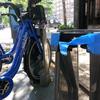
NYC Bike Share Glitches Slow Some Riders
Thursday, May 30, 2013
After nearly four days in operation, New York's bike share program has logged more than 20,000 rides and a few glitches.

Global Road Deaths at All-Time Low, but U.S. Still Ranks Poorly on Safety
Thursday, May 30, 2013
Safety is improving on roads around the world -- but mostly for drivers and passengers in wealthier countries. A study from the Organization of Economic Cooperation and Development's transportation arm finds that although 2012 was a record low year for traffic fatalities, safety for pedestrians isn't increasing as fast as it is car occupants. And the U.S. still ranks poorly compared to other well-off countries.

Behold What NYC's Penn Station Could Be: Four Visions
Wednesday, May 29, 2013
Verdant spirals, heroic domes, river views and, of course, speedy trains: these are some of the possibilities imagined, and visualized in a challenge to redesign Penn Station. Have a look at what four top architecture firms dreamed up.
[UPDATE: See below for Madison Square Garden's none-to-pleased response to the renderings.]

The Transportation Nation Bike Advice Project
Friday, May 24, 2013
With bike share beginning in NYC, potentially thousands of people will be biking New York who haven't ever done so before. They need advice. Let's give them some. Listen to some tips -- and upload your own -- inside.
And for everything else you wanted to know, click here.

Bike Share. The New Corporate Perk.
Thursday, May 16, 2013
The bikes aren't even on the street yet, but New York businesses are planning for the launch of bike share later this month.
While some small storekeepers are bemoaning the big gray docking stations because they take up parking spaces for customers or limit delivery space, larger businesses are taking a rosy view of the city's new transit option.

Who Likes Electric Cars? Rich, Educated, Middle-Aged Men, That's Who
Saturday, May 11, 2013
A study from Norway sheds a little light on what kind of person is buying electric cars, and how they drive.

NYC Gets First Bike Share Apps Before It Gets Bikes
Monday, May 06, 2013
New York City hasn't even finished laying down the 330 docking stations for its impending bike share program, but anticipation is spanning oceans. A Belgian company has released the first "live" mobile app for NYC bike share users, before there are any users. Take it as a sign of what's to come when the largest bike sharing program in the nation launches later this month.

Feds Give Amtrak $30 Million for Northeast Corridor Sandy Rebuilding
Friday, May 03, 2013
Amtrak is getting reimbursed for the $20 million it spent pumping water out of flooded train tunnels during Sandy and additional money to fix infrastructure damaged in the storm. The federal government will give $30 million to the publicly subsidized company, which has said it suffered $60 million in damages from Sandy and needs $250 million to adequately prepare for the next storm.
For comparison, the NY MTA, which runs the NYC subway and commuter rail lines was much harder hit in its miles of electrified underground tunnels. The MTA estimates $5 billion in losses with several billion more needed to prepare for future storms. That agency has received $2 billion in federal relief funds with another $6 billion on the way.

The Curious (Legal) Case of the Bike Share Bollard on Bank Street
Tuesday, April 30, 2013
UPDATE 6:05 p.m. ET: Instead of a bike rack, a massive barricade of rock now sits in front of a tony apartment building in the West Village--a building that filed the first lawsuit against NYC's new bike share program. But it's not clear who put the rock there or why.
Interview: John Mica Argues for Airport Expansion Over "Shortsighted" Airline Objections
Tuesday, April 30, 2013
The former chair of the House Transportation Committee supports expanding the airport in his home district, but opposition is coming from an unexpected corner: airlines. Congressman John Mica (R-Fla.) speaks with WMFE's Matthew Peddie about an airport as an engine of regional growth.

Meet Anthony Foxx, Young Transit-Loving Mayor, Employed by Bus Company, Tapped as U.S. Transpo Secretary
Monday, April 29, 2013
President Barack Obama's choice as the next head of the U.S Department of Transportation is a young urban mayor with a short track record and a fondness for transit.

Brooklynites Like Bike Share, Just Not In Front of Their Homes
Wednesday, April 24, 2013
Changing the face of city sidewalks touches a visceral nerve for neighbors. So it's no surprise that as New York City prepares for the launch of a bike sharing program people are speaking out.

Three Fast Facts on the Carbon Benefits of Transit
Monday, April 22, 2013
Among the Earth Day offerings for those looking to show support for Mother Earth there was: recycling old batteries in a three story tall recycling bin, or browsing guilt-assuaging consumer products made from pulped magazine paper, bamboo shoots or raw moral righteousness. There's also the more mundane act of riding transit.
Here are some stats that crossed the Transportation Nation email inbox this earth day.

2013 Is a Boom Year for Bike Share, Here's Which Cities Will Launch Next (MAP)
Monday, April 22, 2013
North America is seeing a boom in bike sharing program launches. The number of cities planning to add bicycles as public transportation on the continent is expected to jump by 50 percent this year, bringing the total number to 53.

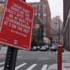
Here's What Boston's Transportation Lockdown Looked Like
Friday, April 19, 2013
With a massive manhunt underway for the suspect in Monday's Boston marathon bombing, Boston's metropolitan area is experiencing near total transportation shutdown. And it's shocking in its scope.
TN MOVING STORIES: Transpo News Links from Around the Web
Thursday, April 18, 2013
