
Map | Tracking the Trail of a Possible Serial Killer on Long Island
WNYC News | Apr 14, 2011
State and local law enforcement along with the FBI are scouring on remote stretch of beach highway on Long Island in search of possible victims of a serial killer. Nassau County authorities said the search will now focus on areas that have been inaccessible by foot, where objects were spotted by helicopter.
The FBI says it will supply aircraft with high-tech photo equipment to assist in the search of the vast shoreline, which will start on Friday.
The investigation spans Suffolk and Nassau counties and investigators say the terrain is rugged.
Below is a map of information authorities have released so far.
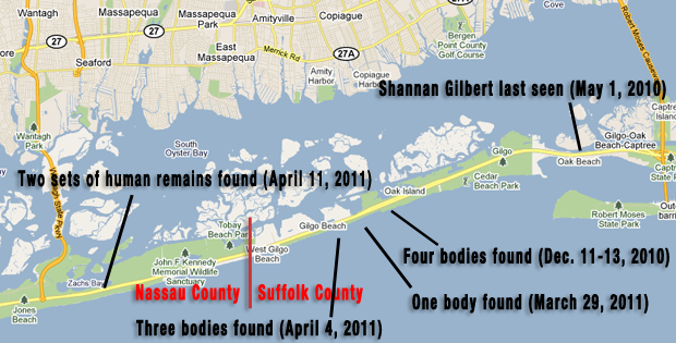
(Google Maps/ Stephen Nessen WNYC)