An Astronaut's View From Space
This segment originally aired live on December 14, 2014. An edited version was included in a best-of episode of The Brian Lehrer Show on December 24, 2014. The unedited audio can be found here.
Astronaut Chris Hadfield shares pictures of Earth he took from space in his new book, You Are Here: Around the World in 92 Minutes: Photographs from the International Space Station (Little, Brown and Company, 2014).
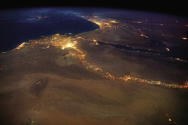
1. The Nile, draining out into the Mediterranean. The bright lights of Cairo announce the opening of the north-flowing river’s delta, with Jerusalem’s answering high beams to the northeast. This 4,258 mile braid of human life, first navigated end-to-end in 2004, is visible in a single glance from space:
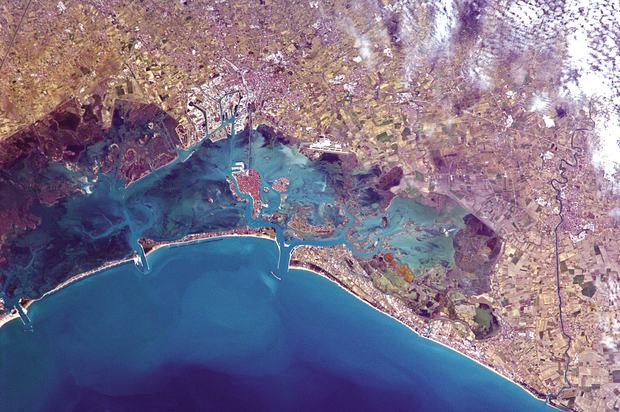
2. Venice, Floating:
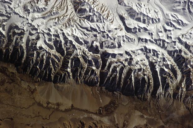
3. The Himalayas:
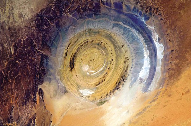
4. The Richat Structure in Mauritania, also known as the Eye of the Sahara, is a landmark for astronauts. If you’ve been busy doing experiments and haven’t looked out the window for a while, it’s hard to know where you are, especially if you’re over a vast 3,600,000-square-mile desert. This bull’s-eye orients you, instantly. Oddly, it appears not to be the scar of a meteorite but a deeply eroded dome, with a rainbow-inspired color scheme:
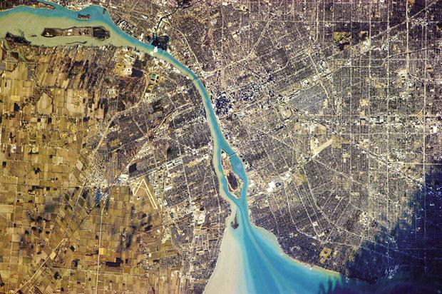
5. Detroit, Michigan, right, and Windsor, Ontario—two countries, one river:
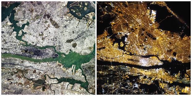
6. Manhattan awake, 9:23 AM local time; Manhattan at rest, 3:45 AM local time:
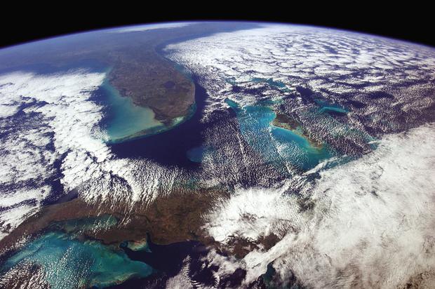
7. On a clear day you can see forever (or at least form Havana to Washington, D.C.):
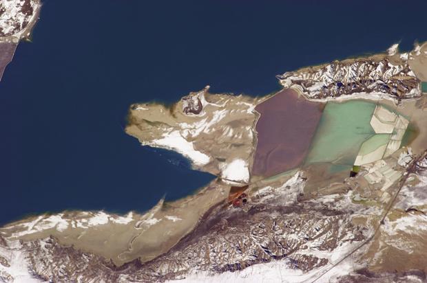
8. Salt from evaporation ponds in Great Salt Lake, Utah, is used to produce a lot of the world’s magnesium metal. The largest saline lake in the western hemisphere attracts pastel-colored algae, brine shrimp and the birds that love them, but so far, just this one lone wolf:
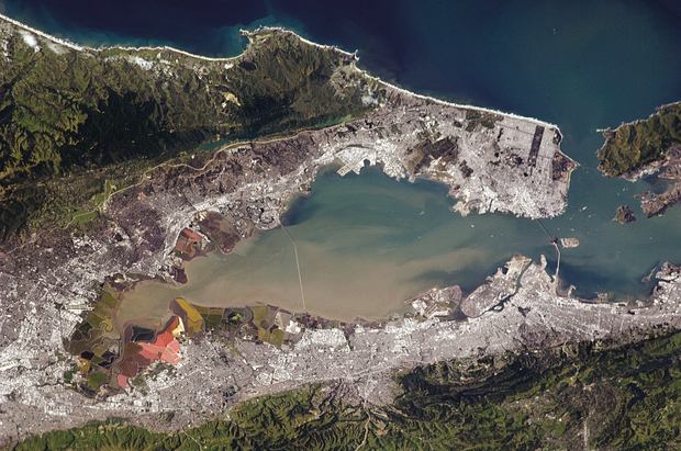
9. Much of the densely built-up waterfront around San Francisco sits on landfill, often a blend of rubble and sediment dragged up from the bay. In a major earthquake, landfill is more prone to liquefaction than bedrock: it behaves like a liquid, shaking far more severely, and is more likely to give way altogether:
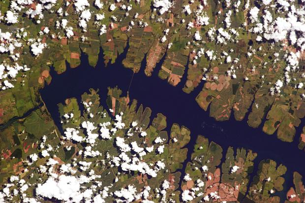
10. The area around Perereira Barreto in Brazil, about 400 miles north of São Paolo, was originally settled in the 1920s by Japanese immigrants who worked on coffee and sugar plantation along the Rio Tietê. But in the 1990s, the river was dammed to create a hydroelectric power plant, flooding and permanently submerging many farms and even a suspension bridge across the Tietê. Today there’s a new bridge, and from this angle, the body of water looks like a millipede:
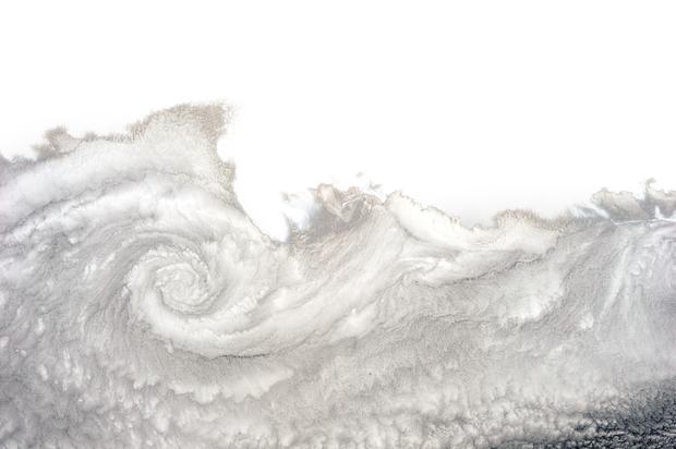
11. A twist of cloud near Arica, Chile. You see these frequently in this part of the world because the Pacific is cold, the land is warm, and the currents and winds combine to form a cloudy vortex—clockwise here, because it’s the southern hemisphere. North of the equator, the spiral would turn counter-clockwise: